Image credit: X @RSFSudan
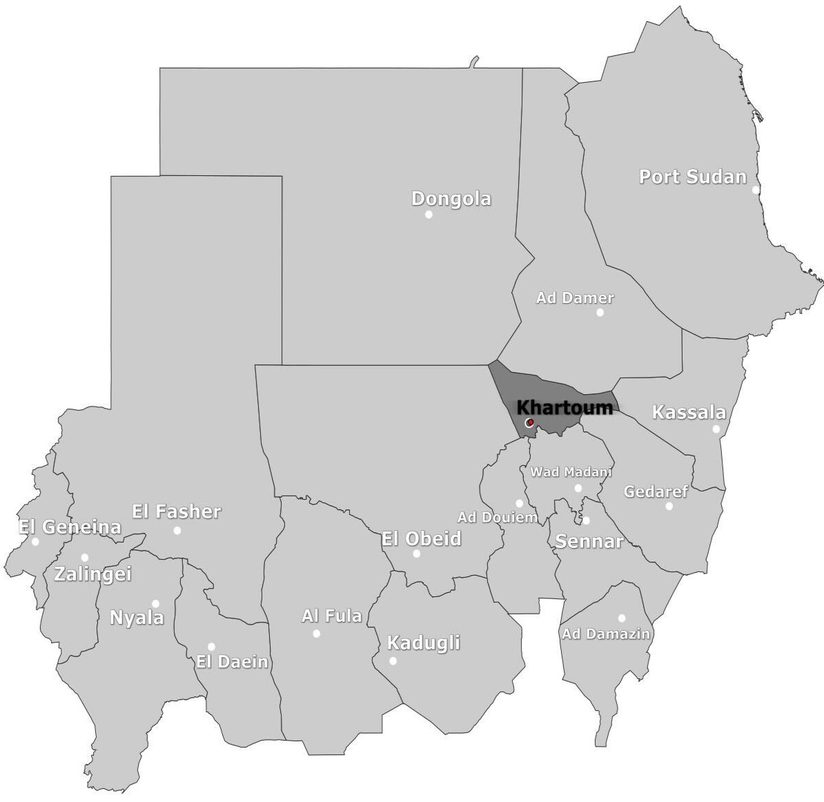
 Figure 1: Location of Al Taif neighbourhood, Khartoum [15.564877,32.572084]
Khartoum, the capital of and largest metropolitan area in Sudan, has been widely affected by fighting between the Rapid Support Forces (RSF) and Sudanese Armed Forces (SAF) since April 2023.
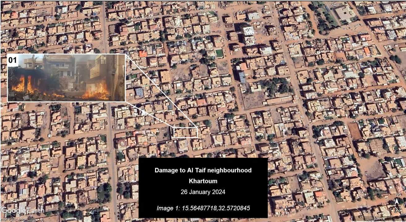
On 26 January 2024, the official X account for the RSF posted a video showing destruction to a residential neighbourhood. The video shows a destroyed housing complex, and debris and fires scattered across the street. Several surrounding houses are also damaged and some have collapsed. Sudan Witness geolocated the footage to Al-Taif neighbourhood near Al-Nakheel Street in Khartoum (figure 2). The neighbourhood is located just over 5km southeast of downtown Khartoum and lies southeast of Khartoum International Airport.
 Figure 2: Geolocation of footage showing a destroyed building in Al Taif Neighbourhood, Khartoum [15.56487718,32.5720845] Source: Google Earth and X
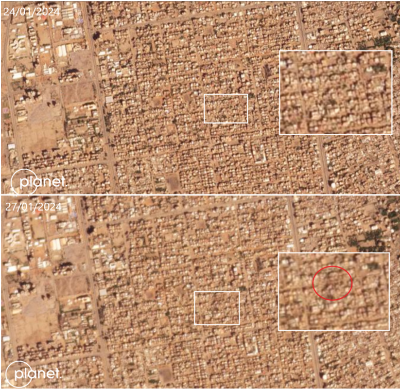
Sudan Witness chronolocated this incident to 26 January 2024, the same day the footage was first published. Planet satellite imagery showed that damage to the neighbourhood first appeared on 27 January, with dark patches visible on the ground on Nakheel Street (figure 3).
 Figure 3: Planet satellite imagery showing destruction to Al Taif neighbourhood. Source: Planet
Several accounts, including a pro-RSF influencer account on X, posted supplementary footage showing the damaged buildings. They claimed the footage showed the aftermath of an SAF airstrike on civilian homes in the Al Taif neighbourhood, however, Sudan Witness has not yet seen any visual evidence of an airstrike. Sudan Witness could not verify attribution, but assesses that it is likely that the SAF was responsible for the incident as there is no available evidence showing the RSF have the capacity to operate helicopters or jets to carry out airstrikes.
لقراءة المقال بالعربية

