CIR has verified large fires which destroyed a market and an industrial area north of central Omdurman between 2 July and 5 July 2023.
CIR cross-referenced satellite imagery with heat anomalies detected using NASAFIRMS to verify a series of large fires that caused further destruction to a crop market (location shown on Wikimapia), the central market and an industrial area to the north in Central Omdurman.
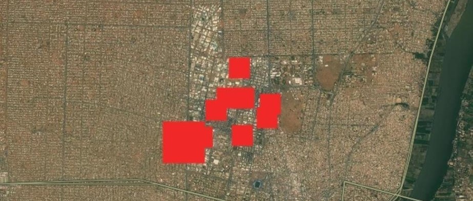
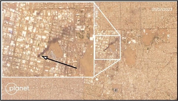
Figure 1 shows all heat signatures in the area between 2 and 5 July, demonstrating the extent of the fires. Figure 2 shows a large plume of smoke from a large warehouse building, to the north of the market, across the street from Ibrahim Abdul Rahman Mosque (located on Google Earth).

Figure 1: Merged heat anomaly signatures between 2-5 July 2023 over Central Omdurman [15.66148,32.466817]

Figure 2: PlanetLabs satellite imagery of the Central area of Omdurman on 5 July 2023 [15.66148,32.466817]
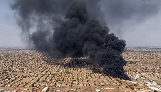
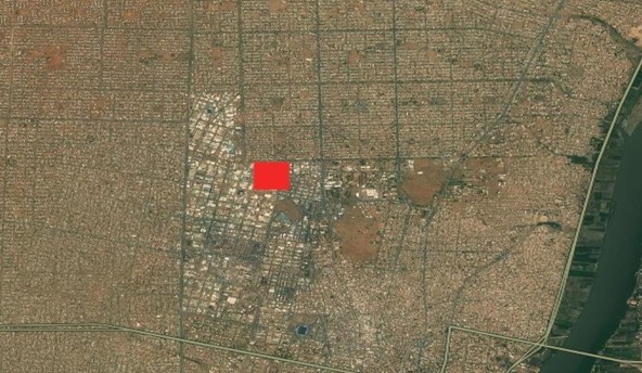
On 3 July 2023, a drone operator based in Khartoum picked up a large smoke plume from a fire coming from West Al-Thawrat, an industrial area just north of the Central Omdurman Market (Figure 3). Using NASAFIRMS data and Google Earth, CIR verified the location and date of the footage (Figure 4). Reports on social media varied on the function of the facility, the most common claim was that it was a plastic materials products factory.

Figure 3: Drone footage showing a large fire in Omdurman Industrial district [15.675302,32.461024]

Figure 4: NASAFIRMS imagery showing an anomaly over the site of the fire in Omdurman Industrial district.
Conclusion
Although the market sustained damage from the conflict prior to these fires, evidenced by a video posted by an individual on Twitter, the wholesale destruction of key food and industrial infrastructure has critical implications to the needs of people still in the area and longer-term food security.
لقراءة المقال بالعربية

