According to eyewitness testimony reported by Myanmar Now and Mandalay Free Press, six unarmed internally displaced people (IDPs) sheltering in the Myat Saw Nyi Naung pagoda compound near Kan Pyar (ကန်ပြား) village [22.034370, 95.613166] were shot by military forces on the afternoon of 6 June 2022.
Myanmar Witness was able to geolocate and verify fire damage and images of corpses with graphic injuries in Kan Pyar (ကန်ပြား) on 6 June 2022, consistent with eyewitness reporting of the shooting of those individuals and burning of civilian infrastructure by the Myanmar military.
Key Event Details
Location of Incident: North of Kan Pyar (ကန်ပြား) [22.034370, 95.613166], Myinmu (မြင်းမူ) Township, Sagaing (စစ်ကိုင်း).
Date/Time of Incident: 06 June 2022, circa 1330 local time.
Alleged Perpetrator(s) and/or Involvement: The Myanmar military (no further specification at this time).
Myanmar Witness Conclusions:
Myanmar Witness geolocated footage of four dead bodies, two with severe injuries consistent with bullet wounds, to the pagoda compound where the incident reportedly took place. The bodies were in civilian clothes; no weapons were visible.
The images show possible exit wounds on the fronts of two bodies; consistent with eyewitness testimony that they were shot in the back. The precise details of their deaths cannot be confirmed through open-source methods.
Myanmar Witness verified footage showing burnt motorcycles and buildings at the site of the incident, as reported by eyewitnesses. NASA FIRMS shows fires at 13.45 on 6 June – 15 minutes after soldiers allegedly entered the village.
Myanmar Witness has pulled together a timeline indicating an active military presence in the area. This includes third party reports of military movements consistent with eyewitness testimony regarding the military presence in Kan Pyar (ကန်ပြား) on the day of the incident. However, there was no verifiable footage of the military in the area at the time of the incident.
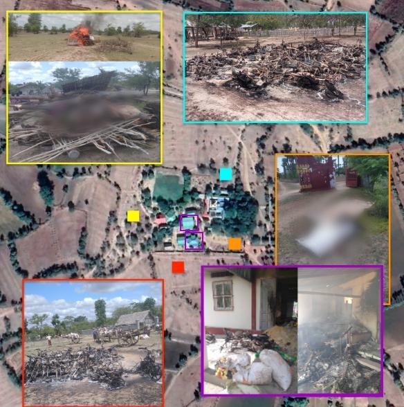
Figure: Mapping of the Myat Saw Nyi Naung Pagoda compound near, Kan Pyar (ကန်ပြား) village. The squares demonstrate images that have been geolocated to these areas. Orange is the location of some of the bodies, purple is the location of burned structures, red and blue corresponds to burned motorbikes and yellow demonstrates the location of the funeral pyre.
Summary
On 6 June 2022, a convoy of around 80 Myanmar soldiers reportedly approached the Myat Saw Nyi Naung pagoda compound at 1330 local time. The soldiers asked those present to escort them to the nearby village of Pe Ku (ပဲကူ) [21.973579, 95.522476]. This request was refused. Analysis of PDF posts by Myanmar Witness in the run-up to the incident includes multiple reports of attacks on the roads between Kan Pyar (ကန်ပြား) and Pe Ku (ပဲကူ). These could explain the request for an escort. This practice of escorting is also consistent with reports of the use of human shields by the Myanmar military.
After failing to identify the owner of a gun found under a motorbike, the soldiers reportedly herded 30 of those present to the pagoda. They ordered them to run to the monastery, launching a countdown which caused panic. The soldiers then opened fire, killing six individuals as they fled.
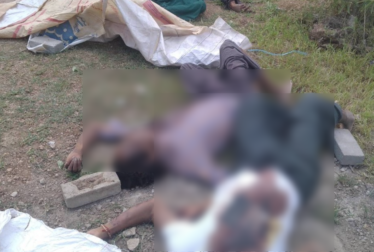
Figure: Images of deceased individuals located close to the pagoda compound main gate showing potential exit wounds.
The victims were reported to be between 16 and 50 years old, shot in the back and head. Named among the dead were Hla Soe (50 years old) Myint Oo (50 years old), Nezar Aung (a CDM teacher in his 30s), Ko Yu Pa (age not reported), and Aye Min Naing, a 16-year-old boy allegedly suffering from mental illness. 30 people reportedly fled the area following the incident.
Myanmar Witness was able to geolocate images showing four dead bodies to the site of the pagoda compound. Wounds on two of the bodies were consistent with bullet wounds, with possible exit wounds on the fronts of the bodies. The location of these bodies was consistent with people running in the direction described. Footage of one further body could not be geolocated. Myanmar Witness also geolocated images showing a funeral pyre at the same compound.
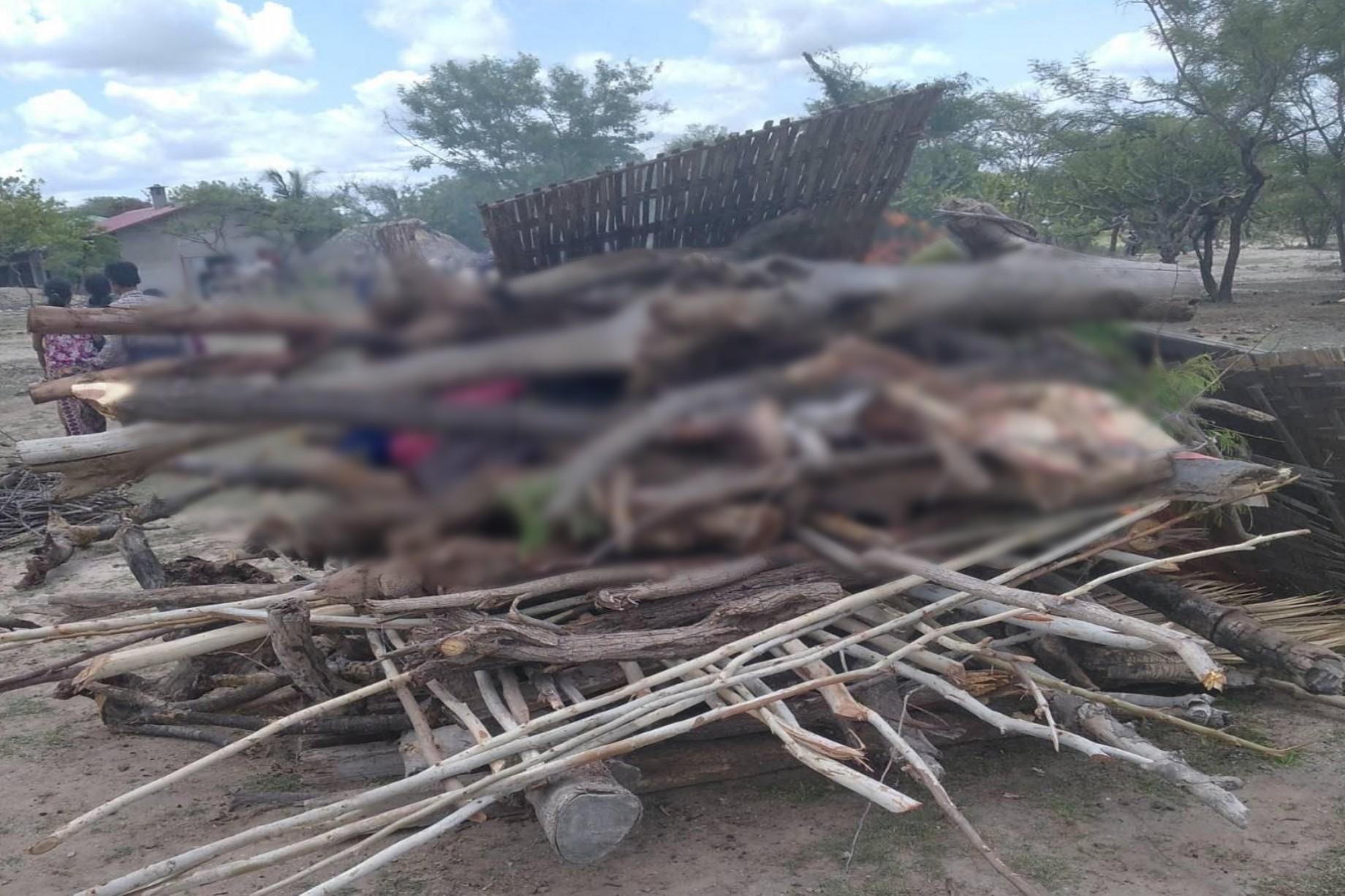
Figure: Images of the cremation site where villagers cremated the dead, was geolocated to this area [22.043901, 95.610348]. The image has been edited by Myanmar Witness to censor the bodies in the image. No further alterations have been made.
Using satellite and NASA FIRMS fire data, Myanmar Witness was able to geolocate and chronolocate footage showing burnt motorcycles and buildings to the compound. NASA FIRMS fire data shows fires at the location at 13.45 on 6 June, 15 minutes after soldiers allegedly entered the area.
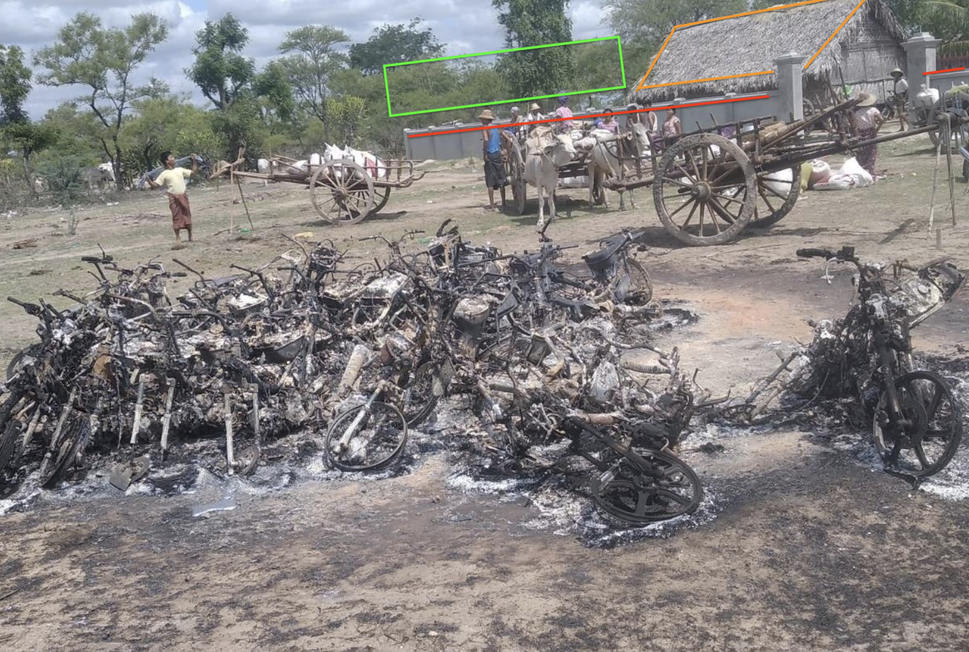
Figure: Aftermath of burnt motorcycles.
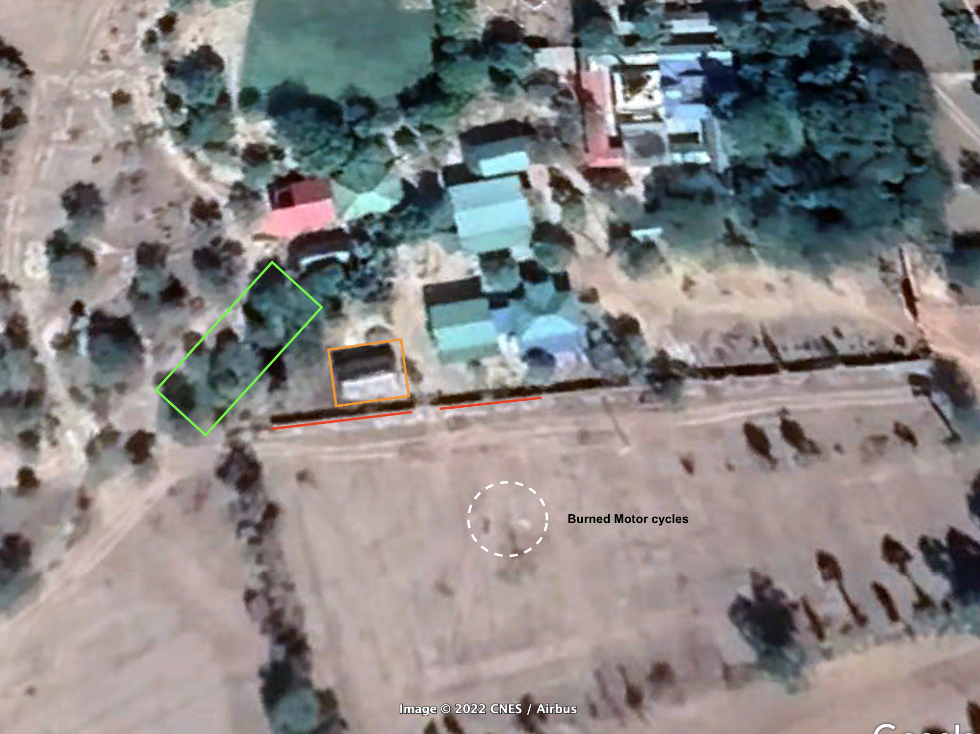
Figure: Location of burned motorcycles at 22.043434, 95.610876 in relation to Myat Saw Nyi Naung Pagoda
While there was no verifiable footage of the military at the site at the time of the incident, there are multiple reports on social media of an active military presence in the area surrounding Kan Pyar (ကန်ပြား) before and after 6 June 2021. In the months preceding the incident, Myanmar Witness verified large-scale fire damage in two villages in the area, allegedly set by the military.

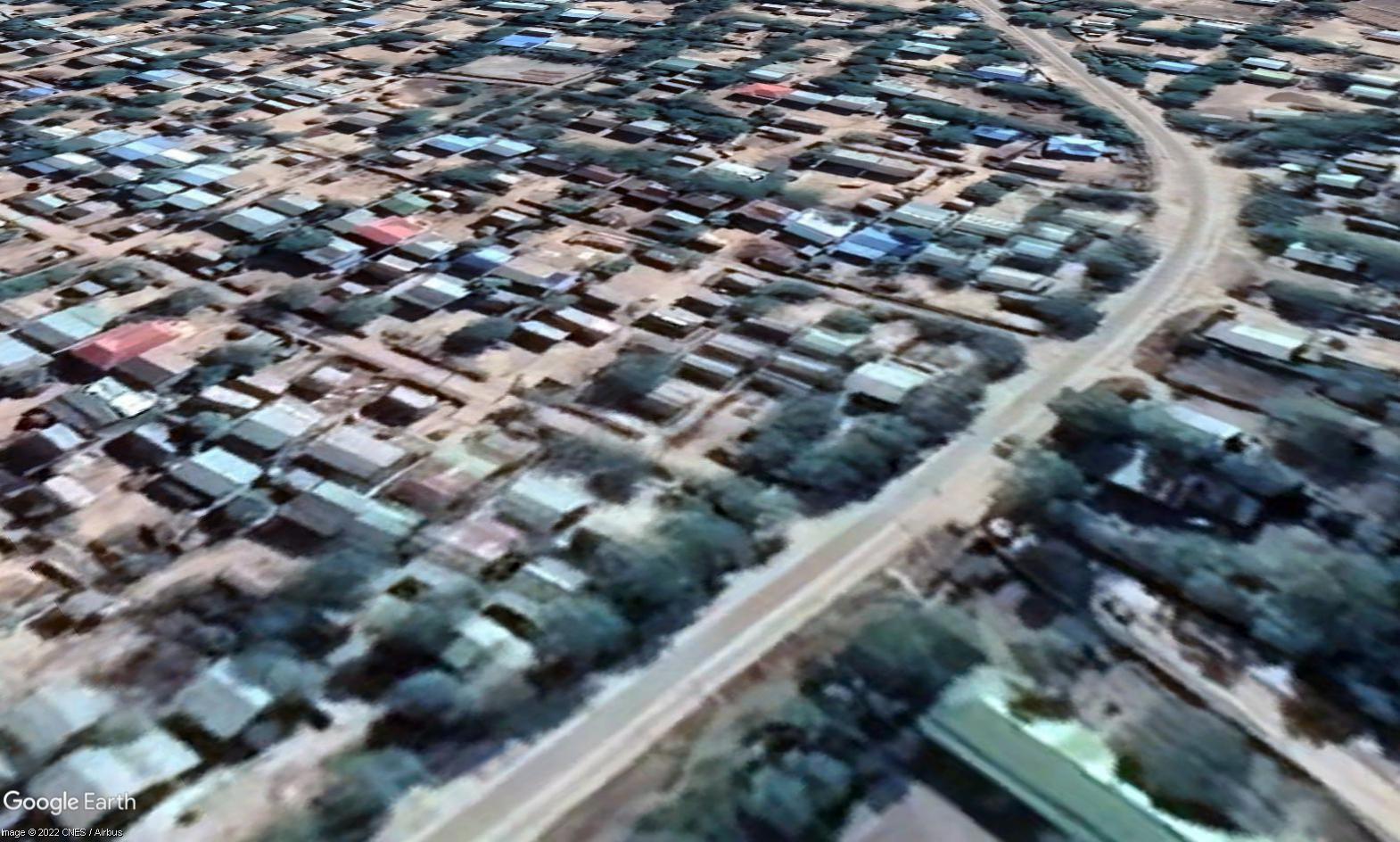
Figure: Geolocation of Kan Taw (ကန်တော်) village at 22.015464, 95.572856 using Google Imagery updated between 15 December 2021 and 8 January 2022 compared to an uploaded image.
This incident is one of many monitored and analysed by Myanmar Witness documenting what is alleged to be security forces targeting civilians. With the addition of PDF activity reported in the area, this incident could also fall within the wider trend of retaliatory attack against communities, as documented in Myanmar Witness’ recent report on trends in north-west Myanmar.
To read the full report, download the report PDF.


