About the Israel-Gaza Conflict Map

The Israel-Gaza Conflict Map is a map of incidents documented by CIR covering the Occupied Palestinian Territories (the Gaza Strip, the West Bank, and East Jerusalem), Israel, and Lebanon since 7 October 2023. We are publishing and updating this map to enhance public access and comprehension of verified information related to the conflict.

How to use the map

The Israel-Gaza Conflict Map integrates a database of verified media related to the Occupied Palestinian Territories (OPTs), Israel and Lebanon, collected by CIR and compiled into incidents.

Incidents have been visually verified using videos and photos uploaded from the ground, as well as satellite imagery, to identify when the incident happened (date) and where it happened (location). Each piece of data has been analysed for authenticity by CIR Investigators. Users can filter data on the map through features such as:

  • Define a date range
  • Select one or multiple incident categories
  • Select one or multiple location zones
  • Filter to include only incidents involving casualties or casualties of minors
  • Use the free text search for keywords, including place names
  • Measure a distance or a geographic area

The number of incidents is updated according to the selection. These search filters may be applied independently or in combination. Explanations of the categories are provided below. The map displays data filtered by the chosen parameters.  Each map pin represents a verified incident, enabling further exploration:

  • Hover over a pin to see a description of the incident
  • Click a pin for a pop-up box listing the incident’s key details and a link to the original source with a graphic warning level
  • Select out of three base maps
  • Zoom in or out to view only events within the frame

Methodology

CIR ensures all information collected is preserved, verified, analysed, investigated and reported in a manner consistent with the guidelines published by the European Union Agency for Criminal Justice Cooperation (Eurojust) and the International Criminal Court (ICC). These guidelines detail the best practices for human rights evidence safekeeping and reliance for later judicial use.

The diagram below illustrates this methodology:

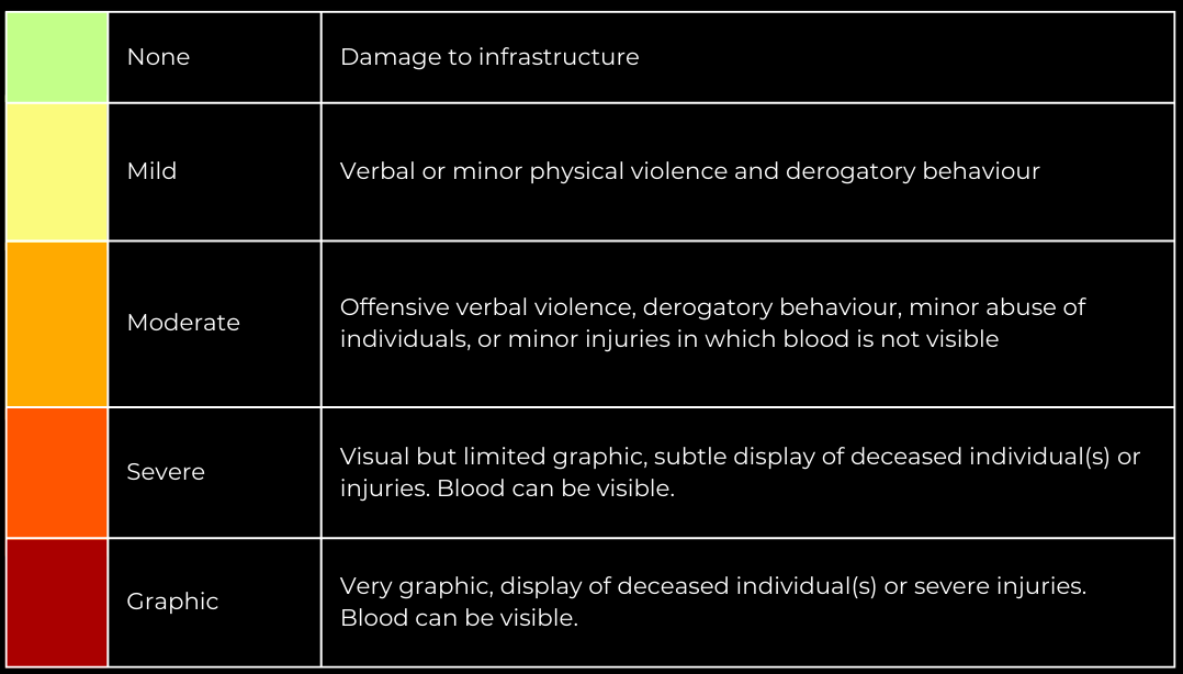
Violence Level

CIR categorises all pieces of content into five graphic levels, which are also noted within CIR’s spreadsheet of incidents:

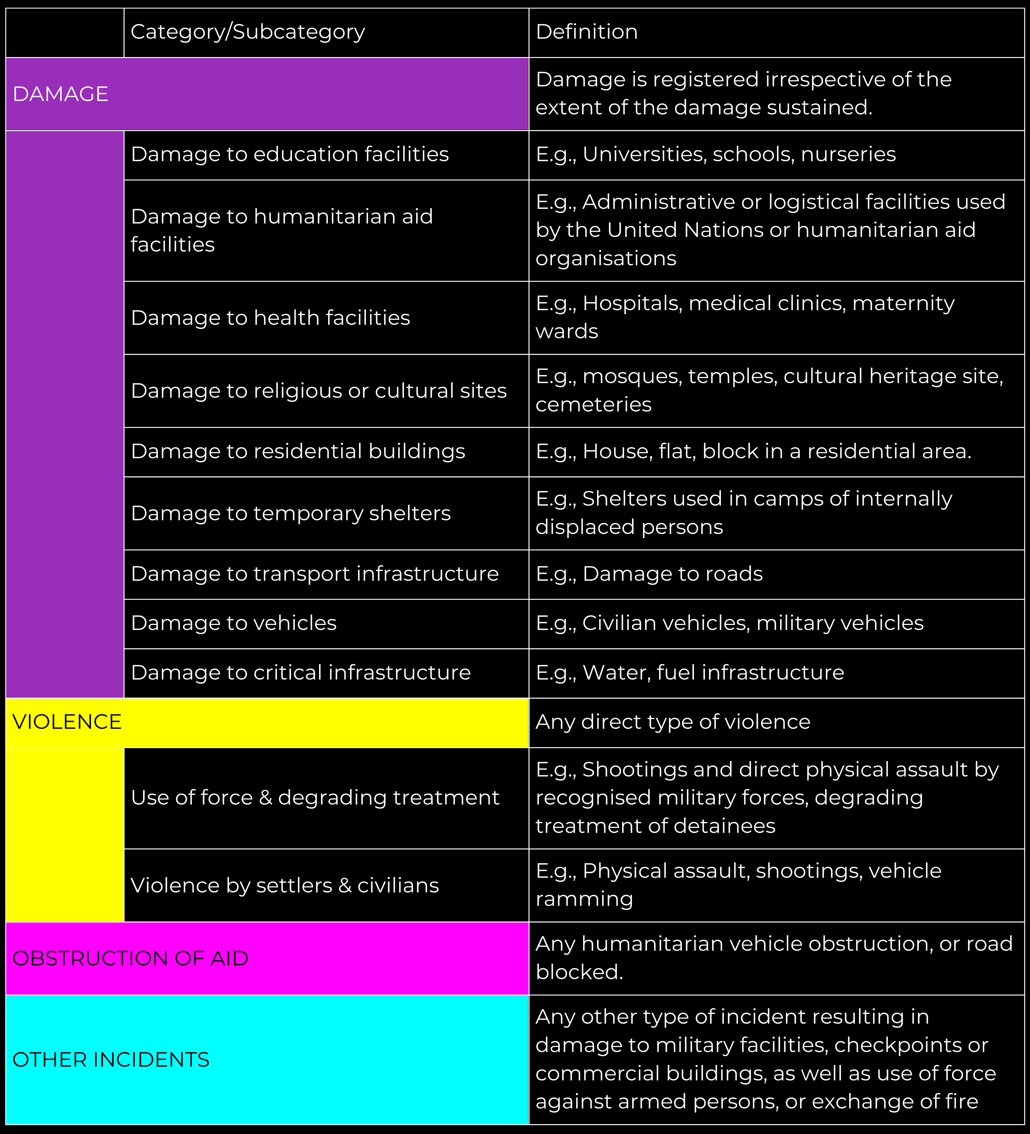
Definitions

Casualties

There are two filters regarding casualties.

Note that “possible covered body” is not counted as a casualty but is mentioned in the incident description.

Disclaimers

CIR does not publish information that could endanger individuals and has a delay of data release to mitigate any harm caused through the mapping of incidents.

Some links (referenced as ‘IP’ numbers) indicate that the data has been removed.  Additionally, out of a duty of care, some links have been removed. If you require access to links related to a specific IPIN incident or a specific IP link, please contact [email protected] with the Incident number (IPIN) or the link number (IP) as a reference.

CIR uses only verified data and is not accountable for unverified claims circulating on social media.

Our data verification is thorough, involving multiple review stages. For any concerns regarding data accuracy, please contact [email protected] with details, and we will assess the information.

While some data has already been geolocated and analysed by the online community, our methodology mandates a stringent review process by senior CIR investigators.

The national borders illustrated on the map are sourced from the United Nations Office of Humanitarian Affairs (UN OCHA)